Flood Hazard Risk Analysis with Remote Sensing and GISAHP

Flood Hazard Risk Analysis with Remote Sensing and GIS/AHP
Published 3/2024
Duration: 5h42m | .MP4 1280x720, 30 fps(r) | AAC, 44100 Hz, 2ch | 4.17 GB
Genre: eLearning | Language: English
Learn how to make Landslide Risk Analyse for any of the area in this world/ArcGIS Pro
What you'll learn
AHP Method/Mulcti Criteria Decision Method/AHP Online Calculator
Flood Risk Analysis with ArcGIS Pro
Weighted Overlay Analysis/Spatial Analysis Method
How to prepare thematic maps /How to print
GIS Techniques
Schreiber Method
How to prepare NDVI Analysis Map
How to prepare TWI Analysis Map
How to prepare Geomorphology Analysis Map
How to prepare Precipication Analysis Map
How to prepare Landuse and Lancover Analysis Map
How to prepare Drainage Density Analysis Map
Proximity Analysis
Raster Calculator (Landsat 8 Bands)
More and more/Smallest details for GIS..
Requirements
ArcGS Pro or ArcGIS Desktop (10.8)
Description
Hello,
The weights and
effects of 10 different layers
were calculated for the Flood Risk Analysis with the
AHP /multi criteria decision
method with
ArcGIS Pro
. The use of Geographic Information Systems (GIS) and Remote Sensing in risk analysis studies are increasing day by day.
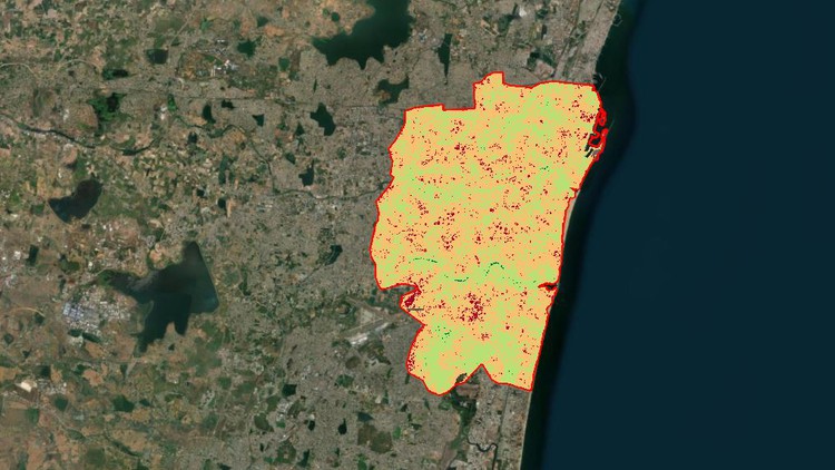
Geographic Information Systems are used to collect, process and analyze existing data in order to identify potential risk areas. In this study, Flood Risk Analysis areas of the
city of Chennai district
were determined by GIS techniques.
In the modeling phase, the Weighted Overlay Analysis method was applied and digital maps .
There are 6 sections and 36 videos. Totally, 5 hours 40 minutes!
Which analysis are we going to prepare?
Elevation,
Slope,
Topographic Wetness İndex
Curvature Analysis,
Precipitation Analysis (By using Schriber Method)
NDVI Analysis,
Landuse and Landcover Analysis,
Distance to stream Analysis/Proximity Analysis
Drainage Density Analysis
Geomorphology Analysis (Jennes Tools/I will provide this tool to you as freely)
You will learn from where to download and how the data to be used in the analysis, what geographical processes it goes through and how it is prepared for analysis.
Raster and vector data how to be prepared one by one, projection conversion operations, adding fields and the shortcuts that will speed up your process when converting from raster to vector and from vector to raster will be especially useful for you. Based on this study, it has been prepared as a resource for you to do a similar study about any part of the world. By sharing the data I used throughout the study with you, I allow you to practice.
Who this course is for:
Hydrology Environmental Engineers
Water Resources Engineers
Surveying Engineers
Planners
Spatial Data Analyst
Students who related with GIS
More Info

[

https://rapidgator.net/file/84a0c335dc4b7532f3c28a8184e411cd/
https://rapidgator.net/file/739afb2e276f569835cc2934c184b3a8/


